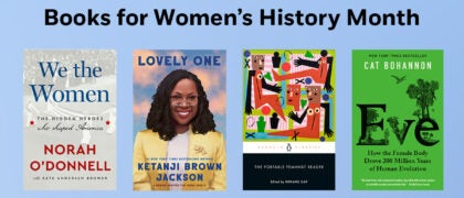
Children's Illustrated World Atlas

Author DK
Hardcover
$17.99 US
0"W x 0"H x 0"D  
On sale Jul 09, 2024 | 144 Pages | 978-0-593-84272-0
| Grades 6-8
Take young readers on the ultimate round-the-world trip with this impressive atlas - packed full of beautiful illustrations and photographs.

Discover the world map-by-map with this exciting world atlas book for children, featuring more than 50 maps! Each page is filled with fascinating information, facts and colorful illustrations of our world. 

Children aged 9-12 will love to learn all about the many countries, cultures and people of the world through vibrant maps. Fascinating facts, local stories, vivid pictures, and clear, satellite-based maps together make this atlas a global yet personal experience for young readers.

This illustrated atlas book for children offers: 

- Bite-sized information giving the profiles, facts, stats and flags of every country.
- Pictures and stories explaining the society, culture and history of each region.
- Maps created using satellite imagery providing a clear view of the world map-by-map.
- A variety of topics covered, including population density, wealth, and internet access shown through graphics.

From Bangkok's floating markets to the carnival in Venice, the Children's Illustrated World Atlas brings together views from windows all over the world. This illustrated atlas not only portrays regions, such as the Siberian wastes, with beautifully detailed maps but also describes the peoples who live there
We believe in the power of discovery. That's why we create books for everyone that explore ideas and nurture curiosity about the world we live in.
 
From first words to the Big Bang, from the wonders of nature to city adventures, you will find expert knowledge, hours of fun and endless inspiration in the pages of our books. 

https://www.dk.com/ View titles by DK
additional book photo

About

Take young readers on the ultimate round-the-world trip with this impressive atlas - packed full of beautiful illustrations and photographs.

Discover the world map-by-map with this exciting world atlas book for children, featuring more than 50 maps! Each page is filled with fascinating information, facts and colorful illustrations of our world. 

Children aged 9-12 will love to learn all about the many countries, cultures and people of the world through vibrant maps. Fascinating facts, local stories, vivid pictures, and clear, satellite-based maps together make this atlas a global yet personal experience for young readers.

This illustrated atlas book for children offers: 

- Bite-sized information giving the profiles, facts, stats and flags of every country.
- Pictures and stories explaining the society, culture and history of each region.
- Maps created using satellite imagery providing a clear view of the world map-by-map.
- A variety of topics covered, including population density, wealth, and internet access shown through graphics.

From Bangkok's floating markets to the carnival in Venice, the Children's Illustrated World Atlas brings together views from windows all over the world. This illustrated atlas not only portrays regions, such as the Siberian wastes, with beautifully detailed maps but also describes the peoples who live there

Author

We believe in the power of discovery. That's why we create books for everyone that explore ideas and nurture curiosity about the world we live in.
 
From first words to the Big Bang, from the wonders of nature to city adventures, you will find expert knowledge, hours of fun and endless inspiration in the pages of our books. 

https://www.dk.com/ View titles by DK

Photos

additional book photo

PRH Education High School Collections

All reading communities should contain protected time for the sake of reading. Independent reading practices emphasize the process of making meaning through reading, not an end product. The school culture (teachers, administration, etc.) should affirm this daily practice time as inherently important instructional time for all readers. (NCTE, 2019)   The Penguin Random House High

Read more

PRH Education Translanguaging Collections

Translanguaging is a communicative practice of bilinguals and multilinguals, that is, it is a practice whereby bilinguals and multilinguals use their entire linguistic repertoire to communicate and make meaning (García, 2009; García, Ibarra Johnson, & Seltzer, 2017)   It is through that lens that we have partnered with teacher educators and bilingual education experts, Drs.

Read more

PRH Education Classroom Libraries

“Books are a students’ passport to entering and actively participating in a global society with the empathy, compassion, and knowledge it takes to become the problem solvers the world needs.” –Laura Robb   Research shows that reading and literacy directly impacts students’ academic success and personal growth. To help promote the importance of daily independent

Read more